The Anime Trip
🌐 EN ▾
ItalianoEnglish繁體中文(台灣)繁體中文(香港)日本語
PLAN YOUR TRIPMy tripSign in / Sign upSign in / Sign up
Mikura-jima Island
photo by 名古屋太郎 · CC BY-SA 3.0
Mikura-jima Island
photo by 名古屋太郎 · Public domain

In 1863 the 1,349-ton ship Viking ran aground on the island's rocks in bad weather, and the roughly 250 inhabitants of the time rescued 483 sailors; today the same waters, home to wild Indo-Pacific bottlenose dolphins (ミナミハンドウイルカ), live off dolphin-watching ecotourism.

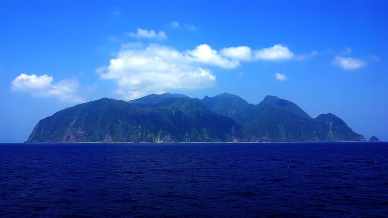
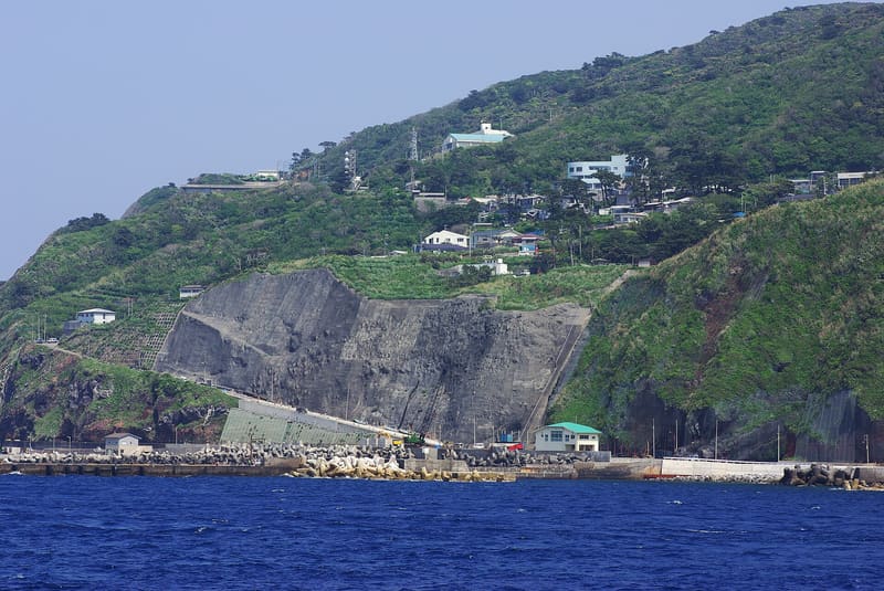
The island measures 20.55 km², with 16.4 km of coastline, and Mount Ōyama in the centre rises to 851 metres; the coastal cliffs reach 500 metres. The wreck of the Viking in 1863, which had sailed from Hong Kong, is the best-documented historical episode on the island. Access is still limited today: only by ship (Tokai Kisen) or helicopter (9 seats), with an accommodation booking required before departure.

Mikura-jima (御蔵島) is an almost circular island in the Izu archipelago, in the municipality of Mikurajima, Tokyo Prefecture, about 190 km south of Tokyo and 19 km south-south-east of Miyake-jima. It has an area of 20.55 km² and a coastline of 16.4 km. The centre of the island is taken up by Mount Ōyama, up to 851 metres high, and its coasts are bounded by cliffs that reach 500 metres. The coordinates of the centre of the island, given in the Wikipedia infobox, are 33°52′27″N 139°36′7″E (33.87417°N 139.60194°E).

ℹ️ The island can be reached on Tokai Kisen's ships Sarubia Maru and Tachibana Maru, on the Tokyo (Takeshiba pier)–Miyake-jima–Mikura-jima–Hachijō-jima route, or by helicopter from Hachijō-jima and Miyake-jima with Toho Airlines/Tokyo Island Shuttle (9 seats, daily flights). Wikipedia notes that sailings are subject to cancellation in bad weather. For a tourist visit, accommodation must be booked in advance: ‘観光目的の来島は事前に宿泊施設...の予約が必要’; places to stay are limited and often full in summer, and staying overnight is in practice unavoidable because the ferries are unreliable.

Holidays in Japan? Plan them with us.Over 2,000 real places, a day-by-day itinerary.FreeOpen the map →

Sources: ja.wikipedia.org

All series · Open the map

Mikura-jima Island
Open on the mapwith over 1,800 wonders of Japan
Mikura-jima Island
photo by 名古屋太郎 · CC BY-SA 3.0
Mikura-jima Island
photo by 名古屋太郎 · Public domain

In 1863 the 1,349-ton ship Viking ran aground on the island's rocks in bad weather, and the roughly 250 inhabitants of the time rescued 483 sailors; today the same waters, home to wild Indo-Pacific bottlenose dolphins (ミナミハンドウイルカ), live off dolphin-watching ecotourism.

The island measures 20.55 km², with 16.4 km of coastline, and Mount Ōyama in the centre rises to 851 metres; the coastal cliffs reach 500 metres. The wreck of the Viking in 1863, which had sailed from Hong Kong, is the best-documented historical episode on the island. Access is still limited today: only by ship (Tokai Kisen) or helicopter (9 seats), with an accommodation booking required before departure.

Mikura-jima (御蔵島) is an almost circular island in the Izu archipelago, in the municipality of Mikurajima, Tokyo Prefecture, about 190 km south of Tokyo and 19 km south-south-east of Miyake-jima. It has an area of 20.55 km² and a coastline of 16.4 km. The centre of the island is taken up by Mount Ōyama, up to 851 metres high, and its coasts are bounded by cliffs that reach 500 metres. The coordinates of the centre of the island, given in the Wikipedia infobox, are 33°52′27″N 139°36′7″E (33.87417°N 139.60194°E).

ℹ️ The island can be reached on Tokai Kisen's ships Sarubia Maru and Tachibana Maru, on the Tokyo (Takeshiba pier)–Miyake-jima–Mikura-jima–Hachijō-jima route, or by helicopter from Hachijō-jima and Miyake-jima with Toho Airlines/Tokyo Island Shuttle (9 seats, daily flights). Wikipedia notes that sailings are subject to cancellation in bad weather. For a tourist visit, accommodation must be booked in advance: ‘観光目的の来島は事前に宿泊施設...の予約が必要’; places to stay are limited and often full in summer, and staying overnight is in practice unavoidable because the ferries are unreliable.

Holidays in Japan? Plan them with us.Over 2,000 real places, a day-by-day itinerary.FreeOpen the map →

Sources: ja.wikipedia.org