The Anime Trip
🌐 EN ▾
ItalianoEnglish繁體中文(台灣)繁體中文(香港)日本語
PLAN YOUR TRIPMy tripSign in / Sign upSign in / Sign up
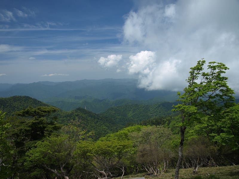
Ōdaigahara
photo by Merec0 · CC BY 2.0
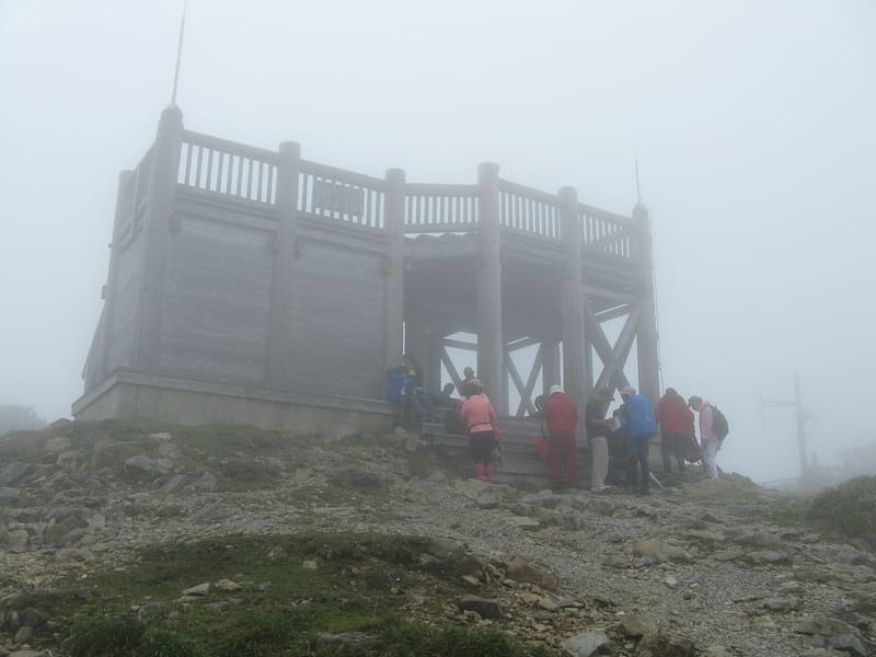
Ōdaigahara
photo by KENPEI · CC BY-SA 3.0

Hidegatake peak, 1,695 m, lies in the area said to be the rainiest in Japan.

You climb to the summit of Hidegatake, the highest point at 1,695 metres, and carry on towards Masakigahara, 1,641 metres, in an area whose rainfall is said to be the heaviest in Japan. Since 1980 it has been a UNESCO biosphere reserve (not a World Heritage Site) under the name Ōdaigahara・Ōmine-san・Ōsugidani. Every year a road cycling race, the Hill Climb Ōdaigahara, covers its 28 kilometres with 1,240 metres of elevation gain.

Ōdaigahara is a mountain plateau in the village of Kamikitayama, in Yoshino District, with two main peaks: Hidegatake, the highest point at 1,695 metres, and Masakigahara at 1,641 metres. Since 1980 it has been part of UNESCO's network of Biosphere Reserves (a different designation from World Heritage), registered under the name Ōdaigahara・Ōmine-san・Ōsugidani.

🚉 大台ヶ原 · in front of the station

Holidays in Japan? Plan them with us.Over 2,000 real places, a day-by-day itinerary.FreeOpen the map →

Sources: yamatoji.nara-kankou.or.jp

Nearby
All series · Open the map

Ōdaigahara
Open on the mapwith over 1,800 wonders of Japan
Ōdaigahara
photo by Merec0 · CC BY 2.0
Ōdaigahara
photo by KENPEI · CC BY-SA 3.0

Hidegatake peak, 1,695 m, lies in the area said to be the rainiest in Japan.

You climb to the summit of Hidegatake, the highest point at 1,695 metres, and carry on towards Masakigahara, 1,641 metres, in an area whose rainfall is said to be the heaviest in Japan. Since 1980 it has been a UNESCO biosphere reserve (not a World Heritage Site) under the name Ōdaigahara・Ōmine-san・Ōsugidani. Every year a road cycling race, the Hill Climb Ōdaigahara, covers its 28 kilometres with 1,240 metres of elevation gain.

Ōdaigahara is a mountain plateau in the village of Kamikitayama, in Yoshino District, with two main peaks: Hidegatake, the highest point at 1,695 metres, and Masakigahara at 1,641 metres. Since 1980 it has been part of UNESCO's network of Biosphere Reserves (a different designation from World Heritage), registered under the name Ōdaigahara・Ōmine-san・Ōsugidani.

🚉 大台ヶ原 · in front of the station

Holidays in Japan? Plan them with us.Over 2,000 real places, a day-by-day itinerary.FreeOpen the map →

Sources: yamatoji.nara-kankou.or.jp

Nearby