The Anime Trip
🌐 EN ▾
ItalianoEnglish繁體中文(台灣)繁體中文(香港)日本語
PLAN YOUR TRIPMy tripSign in / Sign upSign in / Sign up
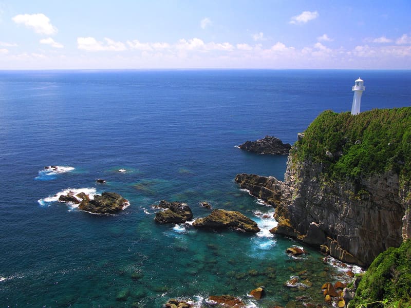
Cape Ashizuri (足摺岬)
photo by 京浜にけ · CC BY-SA 3.0
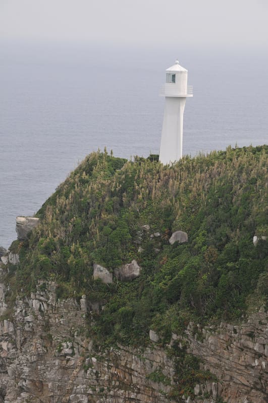
Cape Ashizuri (足摺岬)
photo by Reggaeman · CC BY-SA 3.0

At 14 a shipwreck carried him to America: he came back in 1852 to teach navigation.

The southernmost point of Shikoku, with cliffs dropping sheer into the Pacific and subtropical vegetation. The white lighthouse, first lit in 1914, is 18 metres tall, has a light range of 38 km and is among the most powerful in Japan (46 million candelas). The cape is linked to Nakahama Manjirō (John Manjirō), born in 1827 into a local fishing family: he was shipwrecked at 14 in 1841, drifted with the crew to the uninhabited island of Torishima, and was rescued on 27 June 1841 by the American whaler John Howland, commanded by William Whitfield. Unlike his companions, who went ashore in Hawaii, Manjirō went on to Massachusetts, where he studied English, mathematics, surveying, navigation and shipbuilding at the Bartlett Academy. He returned to Japan in 1852, became a samurai under the name Nakahama and taught Western knowledge of navigation in the period when the country opened up.

In Ashizuri-Uwakai National Park, in the city of Tosashimizu; the vegetation includes wild camellia forests along the cliffs.

ℹ️ Free entry to the cape and the park. Free car parks at several points (tip of the cape 20 spaces, first car park 115, east side 50). Address: 〒787-0315 高知県土佐清水市足摺岬, about 20 minutes (15 km) from Tosashimizu city hall.

🚉 Cape Ashizuri · 8 min walk

Holidays in Japan? Plan them with us.Over 2,000 real places, a day-by-day itinerary.FreeOpen the map →

Sources: city.tosashimizu.kochi.jp · ja.wikipedia.org

All series · Open the map

Cape Ashizuri (足摺岬)
Open on the mapwith over 1,800 wonders of Japan
Cape Ashizuri (足摺岬)
photo by 京浜にけ · CC BY-SA 3.0
Cape Ashizuri (足摺岬)
photo by Reggaeman · CC BY-SA 3.0

At 14 a shipwreck carried him to America: he came back in 1852 to teach navigation.

The southernmost point of Shikoku, with cliffs dropping sheer into the Pacific and subtropical vegetation. The white lighthouse, first lit in 1914, is 18 metres tall, has a light range of 38 km and is among the most powerful in Japan (46 million candelas). The cape is linked to Nakahama Manjirō (John Manjirō), born in 1827 into a local fishing family: he was shipwrecked at 14 in 1841, drifted with the crew to the uninhabited island of Torishima, and was rescued on 27 June 1841 by the American whaler John Howland, commanded by William Whitfield. Unlike his companions, who went ashore in Hawaii, Manjirō went on to Massachusetts, where he studied English, mathematics, surveying, navigation and shipbuilding at the Bartlett Academy. He returned to Japan in 1852, became a samurai under the name Nakahama and taught Western knowledge of navigation in the period when the country opened up.

In Ashizuri-Uwakai National Park, in the city of Tosashimizu; the vegetation includes wild camellia forests along the cliffs.

ℹ️ Free entry to the cape and the park. Free car parks at several points (tip of the cape 20 spaces, first car park 115, east side 50). Address: 〒787-0315 高知県土佐清水市足摺岬, about 20 minutes (15 km) from Tosashimizu city hall.

🚉 Cape Ashizuri · 8 min walk

Holidays in Japan? Plan them with us.Over 2,000 real places, a day-by-day itinerary.FreeOpen the map →

Sources: city.tosashimizu.kochi.jp · ja.wikipedia.org