The Anime Trip
🌐 EN ▾
ItalianoEnglish繁體中文(台灣)繁體中文(香港)日本語
PLAN YOUR TRIPMy tripSign in / Sign upSign in / Sign up
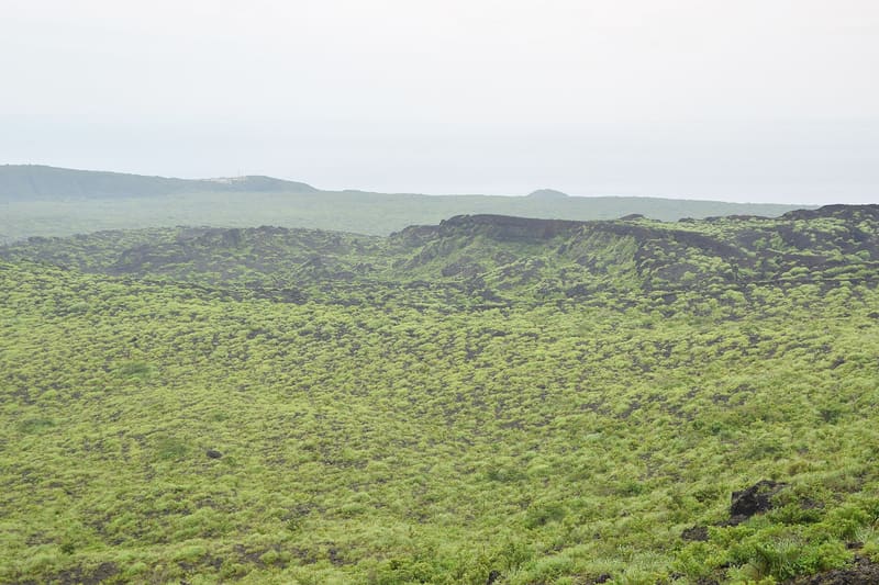
Izu Ōshima
photo by Raita Futo · CC BY 2.0
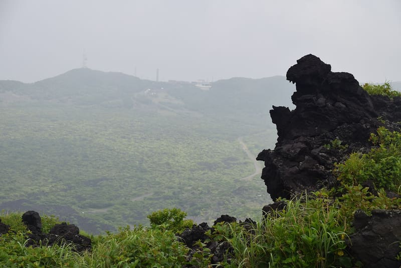
Izu Ōshima
photo by Yoshi Canopus · CC BY-SA 4.0

In 1986 the volcano woke up, and in one night the ten thousand inhabitants left the island.

It is the Tokyo island you can actually reach: an hour and forty-five minutes by hydrofoil from Takeshiba, in the middle of the city, or six hours by night ferry. From Atami it is forty-five minutes, from Itō thirty-five. In the centre stands Mihara, which is an active, monitored volcano, not just any mountain.

Mihara has always erupted: the Meteorological Agency lists its eruptions from 680 onwards, with the large ones of the Jōkyō era (1684–90) and the An'ei era (1777–92). The last large one was in November 1986, and on the night of the 21st all ten thousand inhabitants of the island were taken off it (「21日夜全島民1万人島外へ避難(約1ヶ月)」) and returned about a month later. Since then the volcano has been kept under observation with seismometers, tiltmeters and cameras.

ℹ️ Hydrofoil from Takeshiba 1 hr 45 min, night ferry 6 hr, hydrofoil from Atami 45 min. ⚠️ The summit trail on Mihara has stretches with poor footing, and the Meteorological Agency recommends mountain boots, not town shoes. The municipality keeps a standing page on the state of volcanic activity, and that is the one to check before setting out: the area within 600 m of the summit crater is off limits, official trails excepted. ⚠️ That page, however, carries old dates (the ‘quiet activity’ status is dated 2017 and the 600 m restriction 2010): check it, do not take it at face value.

🚉 Okada-kō (岡田港) / Motomachi-kō (元町港) · 142 min walk

Holidays in Japan? Plan them with us.Over 2,000 real places, a day-by-day itinerary.FreeOpen the map →

Sources: data.jma.go.jp · data.jma.go.jp · town.oshima.tokyo.jp · tokaikisen.co.jp

All series · Open the map

Izu Ōshima
Open on the mapwith over 1,800 wonders of Japan
Izu Ōshima
photo by Raita Futo · CC BY 2.0
Izu Ōshima
photo by Yoshi Canopus · CC BY-SA 4.0

In 1986 the volcano woke up, and in one night the ten thousand inhabitants left the island.

It is the Tokyo island you can actually reach: an hour and forty-five minutes by hydrofoil from Takeshiba, in the middle of the city, or six hours by night ferry. From Atami it is forty-five minutes, from Itō thirty-five. In the centre stands Mihara, which is an active, monitored volcano, not just any mountain.

Mihara has always erupted: the Meteorological Agency lists its eruptions from 680 onwards, with the large ones of the Jōkyō era (1684–90) and the An'ei era (1777–92). The last large one was in November 1986, and on the night of the 21st all ten thousand inhabitants of the island were taken off it (「21日夜全島民1万人島外へ避難(約1ヶ月)」) and returned about a month later. Since then the volcano has been kept under observation with seismometers, tiltmeters and cameras.

ℹ️ Hydrofoil from Takeshiba 1 hr 45 min, night ferry 6 hr, hydrofoil from Atami 45 min. ⚠️ The summit trail on Mihara has stretches with poor footing, and the Meteorological Agency recommends mountain boots, not town shoes. The municipality keeps a standing page on the state of volcanic activity, and that is the one to check before setting out: the area within 600 m of the summit crater is off limits, official trails excepted. ⚠️ That page, however, carries old dates (the ‘quiet activity’ status is dated 2017 and the 600 m restriction 2010): check it, do not take it at face value.

🚉 Okada-kō (岡田港) / Motomachi-kō (元町港) · 142 min walk

Holidays in Japan? Plan them with us.Over 2,000 real places, a day-by-day itinerary.FreeOpen the map →

Sources: data.jma.go.jp · data.jma.go.jp · town.oshima.tokyo.jp · tokaikisen.co.jp